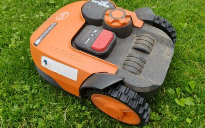
No, a LiDAR robot mower does not need GPS to function. LiDAR (Light Detection and Ranging) uses laser pulses to build a detailed map of your yard in real time, so the mower knows exactly where it is and where it has been without any satellite signal. This makes LiDAR mowers fully operational even under dense tree cover, in narrow side yards, or on cloudy days when GPS signals are weak. The question of whether a LiDAR robot mower needs GPS usually comes from confusion about how different navigation systems work together. While some models combine LiDAR with GPS for extra precision, the LiDAR system alone is self-sufficient for mowing your lawn.

Pros
- All-wheel drive handles steep inclines up to 80% and rough terrain
- Wire-free setup with quick LiDAR mapping saves installation time
- Fast 45-minute recharge for efficient large lawn coverage
- Quiet enough for nighttime mowing, no noise complaints
- Anti-theft 4G tracking and real-time monitoring via app
Cons
- High upfront cost compared to wire-guided mowers
- No user reviews yet, reliability is unproven
- Optional trimmer module required for sub-1.18-inch edge trimming
The Dreame A3 AWD is a high-end robotic lawn mower designed for homeowners with challenging, sloped yards up to 0.5 acre. It eliminates the need for boundary wires or RTK stations, using 360° 3D LiDAR and AI binocular vision to create a precise map of your lawn in minutes. This makes it ideal for those who want a set-and-forget solution without the hassle of installation.
Its standout feature is the all-wheel drive system that tackles inclines up to 80% and obstacles up to 2.17 inches, far beyond what most robotic mowers can handle. The 1.97-inch edge trimming is impressive, and with the optional trimmer module it gets even closer to walls. The 45-minute fast charge is a significant advantage, ensuring the mower can finish a 0.5-acre lawn in a single day.
Build quality appears robust with a weight of 26.4 pounds and a dimensions of 25 x 17.05 x 11.57 inches. The gray color is practical for outdoor use. The Dreamehome App provides full control, including scheduling, custom patterns, and real-time monitoring via the 4G module and HDR camera, which also serves as a theft deterrent.
Potential drawbacks include the high price point and the lack of user reviews, so long-term reliability is unknown. The edge-trimming module is sold separately, which adds cost. Also, while the mower is quiet, it is not completely silent. However, for those tired of manual mowing or paying for lawn care, the A3 AWD offers a compelling, premium solution.
Overall, the Dreame A3 AWD is a top-tier choice for homeowners with steep, complex lawns who want a wire-free, high-performance robotic mower with smart features. It is best for those willing to invest in quality and convenience, and who value no monthly fees. If your yard is relatively flat or small, lower-cost options may suffice, but for challenging terrain, this mower is hard to beat.

Pros
- No need for boundary wires or RTK base stations, simplifying installation and maintenance.
- Exceptional navigation accuracy with 3D LiDAR, works day/night and in poor weather conditions.
- Comprehensive anti-theft features including GPS tracking, device lock, and loud alarm.
- Quiet operation and IPX6 waterproof rating allow easy cleaning with a water jet.
- App control with multi-zone mapping, scheduling, and three preset mowing modes.
Cons
- The AI bionic triple vision module is sold separately, adding extra cost for full Pro features.
- Battery runtime may be limited for larger lawns (max mapping area is 0.37 acre).
- No user reviews yet, so real-world performance and durability are unverified.
The HOOKII Neomow X2 LE is a next-generation robotic lawn mower that eliminates the need for boundary wires or RTK antennas. Designed for small to medium lawns up to 0.37 acre, it uses a 360° 3D LiDAR sensor combined with AI vision to navigate with inch-level precision. This makes it an excellent choice for homeowners who want a truly wire-free setup and reliable performance even under dense trees or at night.
Standout features include the upgraded LiDAR system, which delivers ten times more point cloud data per second for accurate obstacle prediction and intelligent navigation. The GPS anti-theft system adds security with real-time tracking and a loud alarm if the mower is lifted. The 4G app connectivity (with 1GB free data) lets you control and monitor the mower from anywhere, while the 13Ah battery extends runtime to 150 minutes for efficient mowing.
Build quality is robust with an IPX6 waterproof rating, allowing you to rinse the mower clean with a water jet. The cutting deck handles tough grasses like St. Augustine and Bermuda, with height adjustment from 1.18 to 3.35 inches. The base station can be placed indoors for added safety, and the mower auto-recharges and resumes where it left off. However, the AI bionic triple vision module for advanced features like auto-mapping and real-time monitoring is sold separately.
Potential drawbacks include the need to purchase the optional vision module for full Pro capabilities, and the battery range may not suit larger lawns beyond 0.37 acre. Since there are no user reviews yet, long-term reliability is uncertain, but the technical specs are impressive for the price.
Overall, the HOOKII Neomow X2 LE offers a compelling wire-free solution for small lawns. Its combination of 3D LiDAR, GPS anti-theft, and app control makes it a standout choice for tech-savvy homeowners seeking convenience and security. If you value precision and minimal setup, this mower is worth considering.

Pros
- Wire-free operation with no perimeter wires or RTK antenna needed, simplifying installation.
- Exceptional obstacle recognition (500+ types) prevents misjudgments and water accidents.
- High-capacity battery and efficient algorithms maximize runtime and coverage.
- GPS anti-theft and remote lock provide peace of mind for outdoor equipment.
- Ultra-quiet operation and IPX6 waterproof rating for durable, discreet use.
Cons
- Premium price point may not suit budget-conscious buyers.
- Initial mapping and app setup may require some time to learn.
- Limited to 1.5 acres, not ideal for larger properties without additional units.
The HOOKII Neomow X2 Pro is a flagship robotic lawn mower designed for homeowners with lawns up to 1.5 acres who demand cutting-edge technology and minimal maintenance. It combines 360° 3D LiDAR with a triple vision AI system, eliminating the need for perimeter wires or an RTK antenna. This makes it ideal for those with complex or irregularly shaped lawns who want a truly autonomous mowing experience.
Standout features include its inch-level precision navigation, which works reliably in low light and rain, and its ability to recognize over 500 types of obstacles, from leaves to duckweed. The automated mapping is remarkably simple: just tap a button in the app, and the mower creates a detailed map. The upgraded cutting platform handles tough grasses like St. Augustine and Bermuda, with adjustable height settings to suit seasonal needs.
Design-wise, the X2 Pro is robust with an IPX6 waterproof rating, allowing you to hose it clean after use. The built-in speaker provides voice prompts, and the GPS anti-theft system adds security with loud alarms and remote tracking. The 17.5Ah battery delivers up to 200 minutes of runtime, and the mower auto-recharges and resumes, ensuring complete lawn coverage without intervention.
Potential drawbacks include its premium price, which may be a barrier for some, and the initial learning curve for app-based mapping and scheduling. While the 1.5-acre capacity suits many properties, those with larger lawns may need to consider a second unit. Additionally, the mower relies on a stable network connection for full functionality.
Overall, the HOOKII Neomow X2 Pro is a top-tier choice for tech-savvy homeowners who want a wire-free, hands-off lawn care solution with advanced AI and robust security. Its performance and convenience justify the investment for those seeking the best in automated mowing technology.
Product Dimensions: 35 x 16 x 22 inches
Weight: 39.68 pounds
Color: Gray
Lawn Capacity: Up to 1.5 acres
Battery: 17.5Ah, runtime 180-200 minutes
Cutting Height: 1.18 to 3.35 inches, adjustable
Waterproof Rating: IPX6
Connectivity: 2.4GHz WiFi, Bluetooth, 4G (1GB free data)
Navigation: 360° 3D LiDAR + Triple Vision AI, no RTK antenna required
Anti-Theft: GPS tracking, loud alarm, remote lock via app
App Control: HOOKII app with OTA updates, multi-zone management, scheduling

Pros
- No boundary wires or RTK required, simplifying installation and maintenance.
- Advanced 3D LiDAR works reliably day and night, even under trees or in rain.
- Expandable AI vision module adds future-proofing for smarter lawn care.
- Quiet operation and indoor charging station keep the mower secure and neighbor-friendly.
- Strong anti-theft features with GPS tracking and remote lock.
Cons
- AI bionic triple-vision camera is sold separately, adding to the cost for full Pro features.
- Maximum coverage of 0.75 acre may not suit larger lawns without multiple charges.
- No reviews yet, so real-world reliability is unproven despite strong specs.
The HOOKII Neomow X2 SE is a wire-free robot lawn mower designed for homeowners with medium-sized yards up to 0.75 acre. It uses a 360° 3D LiDAR SLAM system that eliminates the need for boundary wires or an RTK antenna, making setup simple and clean. This mower is ideal for those who want a high-tech, low-maintenance lawn care solution with app control and future upgrade options.
Standout features include the upgraded LiDAR that provides 10x more point cloud output per second for inch-level positioning, even in low light or at night. The reserved expansion port for an AI bionic triple-vision camera (sold separately) unlocks auto-mapping, real-time photo monitoring, and over 500 AI obstacle detection models. The cutting platform handles tough grasses like St. Augustine and Bermuda, with electric height adjustment from 1.18 to 3.35 inches and multiple mowing modes.
Design and build quality are robust, with an IPX6 waterproof rating that allows rinsing with a water jet. The 13Ah battery delivers up to 150 minutes runtime, covering about 0.17 acre per charge. The anti-theft system includes a loud alarm, GPS tracking via the app, and remote locking, plus the charging station can be placed indoors for added security. The mower is also ultra-quiet, making it neighbor-friendly.
Potential drawbacks include the AI vision camera being sold separately, which adds cost for full Pro capabilities. The 0.75-acre maximum coverage may require multiple charges for larger lawns, and the product currently has no user reviews, so real-world performance is unverified. However, the specs suggest a well-engineered machine.
Verdict: The HOOKII Neomow X2 SE offers a compelling wire-free, LiDAR-based solution with expandable AI features. It is best for tech-oriented homeowners with medium yards who value precision, security, and quiet operation. If you are willing to invest in the optional camera for advanced features, this mower could be a future-proof choice for effortless lawn care.

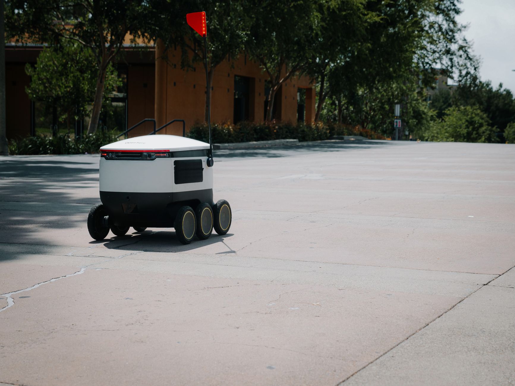
How LiDAR Navigation Works Without GPS
A LiDAR robot mower emits thousands of laser pulses every second. These pulses bounce off objects like trees, fences, and house walls, and the sensor measures the time it takes for each pulse to return. This creates a point cloud that the mower uses to build a 3D map of the environment. The mower then compares its current sensor readings to that map to determine its position and orientation. This process is called simultaneous localization and mapping (SLAM).
Because the map is built and stored locally on the mower, it does not require any external signal. You can run a LiDAR mower in a completely GPS-denied area, such as a courtyard enclosed by tall walls or a yard with a thick canopy of trees. The only requirement is that the mower has a clear view of enough features in the environment to recognize its location.
When GPS Is Added to a LiDAR Mower
Some robot mowers include both LiDAR and GPS sensors. In these models, GPS is not a backup for navigation but a way to add features that LiDAR alone cannot provide. The most common reason is RTK (Real-Time Kinematic) GPS, which offers centimeter-level positioning. This allows the mower to define virtual boundaries without any perimeter wire, even in large open areas where LiDAR might struggle to find enough reference points.
Another use case is recharging and returning to the dock. While LiDAR can guide the mower back to a known location, GPS can help the mower find a more direct path when it is far from the dock. However, many LiDAR-only mowers handle docking just fine by remembering the route.
LiDAR vs. GPS: Key Differences for Robot Mowers
The main difference between LiDAR and GPS navigation is how they perceive the environment. LiDAR is a local sensor that sees obstacles and landmarks in real time, making it excellent for avoiding objects and navigating complex lawns. GPS is a global sensor that tells the mower where it is on Earth, but it cannot see a rock, a flower bed, or a child’s toy. That is why many high-end mowers combine both: LiDAR for obstacle avoidance and GPS for boundary management.
For the average homeowner, a LiDAR-only mower is perfectly capable of mowing most lawns. GPS becomes important only if you have a very large, open yard with few visual features, or if you want to avoid laying any boundary wire at all. In such cases, a mower with RTK GPS may be a better fit.
Advantages of a LiDAR Robot Mower Without GPS
Running a LiDAR mower without GPS has several benefits. First, it works reliably in any weather or light condition. GPS signals can be disrupted by heavy rain, thick clouds, or tall buildings, but LiDAR is unaffected by those factors. Second, LiDAR mowers do not require a clear view of the sky, so they can operate in tight spaces or under pergolas.
Third, LiDAR navigation is generally more precise for obstacle avoidance. The sensor can detect objects as small as a few centimeters, allowing the mower to maneuver around garden furniture, sprinklers, and tree roots without bumping into them. This reduces wear on the mower and keeps your lawn looking neat.
Limitations of LiDAR Only (and How GPS Helps)
LiDAR is not perfect. It can be confused by featureless environments like a very flat, open lawn with no trees or fences. In such spaces, the sensor may not find enough distinct points to maintain its map, and the mower could drift. Adding GPS, especially RTK, solves this by providing absolute positioning even when the local map is sparse.
Also, LiDAR maps can shift over time if the mower’s sensors get dirty or if the environment changes significantly (e.g., new landscaping). Some models require a remapping after major changes. GPS can help the mower reorient itself faster, but most LiDAR mowers can handle incremental changes by updating their map during each mowing session.
How to Choose: What to Consider
When deciding whether you need a LiDAR mower with or without GPS, think about your yard’s layout. If your lawn has plenty of trees, bushes, fences, or buildings, a LiDAR-only mower will work excellently. If your yard is a large, open rectangle with no features, you might benefit from a model that includes RTK GPS for boundary definition.
Also consider whether you want to avoid installing a perimeter wire. LiDAR mowers typically do not need boundary wire for navigation, but some models still require it for virtual boundaries. If you want a completely wire-free setup, look for a mower that uses RTK GPS for boundaries alongside LiDAR for obstacle avoidance.
What to Do: Practical Steps
- If you already own a LiDAR mower, check the user manual to see if it uses GPS as an optional feature. Most do not require it, so you can ignore the GPS component if your yard is well-featured.
- If you are shopping for a new mower, test your yard’s GPS signal strength using a smartphone app. If you get a weak signal in parts of your lawn, a LiDAR-only mower may be more reliable.
- For large, open lawns where you want to avoid boundary wire, consider a mower that combines LiDAR with RTK GPS. This will give you the best of both worlds.
- If you are unsure about navigation options, read our guide on how to map a wire-free robot mower. It explains the mapping process for LiDAR and other systems, helping you understand what to expect.
That linked post covers the step-by-step setup for wire-free mowers, which is exactly what you would do with a LiDAR-based model. It will give you a clear picture of how the mapping works and whether it fits your yard.
Frequently Asked Questions
Can a LiDAR mower work without any GPS signal?
Yes, absolutely. A LiDAR mower does not use GPS for navigation. It builds its own map using laser scanning, so it works perfectly in areas with no GPS signal, such as under trees, in courtyards, or between tall buildings.
Is LiDAR more reliable than GPS for robot mowing?
For most lawns, LiDAR is more reliable because it is not affected by weather, sky visibility, or satellite signal strength. GPS can lose accuracy in cloudy conditions or near tall structures, while LiDAR sees the environment directly.
Do I need RTK if I have LiDAR on my mower?
Not necessarily. RTK GPS adds centimeter-level positioning for virtual boundaries, but LiDAR alone can handle obstacle avoidance and navigation. You only need RTK if you want to avoid any boundary wire and have a large, open yard.
What happens if a LiDAR mower loses its map?
Most LiDAR mowers can rebuild their map during the next mowing session by scanning the environment again. Some models store a backup map, and you can usually trigger a remap from the app. GPS can help speed up reorientation, but it is not required.
Can LiDAR mowers handle slopes without GPS?
Yes, LiDAR mowers handle slopes by using their tilt sensors and the laser map to maintain orientation. GPS does not directly help with slope handling. The mower’s traction and wheel design matter more for steep terrain.
Related Guides
- Does LiDAR Robot Mower Work Under Trees?
- Does LiDAR Robot Mower Work at Night?
- Sunseeker Robot Mower Cyber Monday Deals
Closing Thoughts
In short, a LiDAR robot mower does not need GPS to operate effectively. It is a self-contained navigation system that works in most environments. If you want to understand how RTK GPS can complement LiDAR for boundary-free mowing, explore our explanation of what RTK is on a robot lawn mower.